Summary: Latitude vs. X
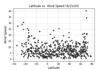
In order to analyze the elementary question, "What is the weather like as you approach the equator?" I used a simple Python library, the OpenWeatherMap API, and a little common sense to create a representative model of weather across world cities. While it is likely what you would expect, take a look at the data to confirm your theory for yourself. Using Python script to visualize the weather of 500+ cities across the world, of varying distance from the equator, you will be able to determine the answer for yourself.
Visualizations
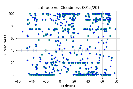
Cloudiness
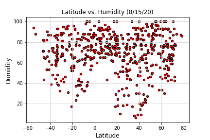
Humidity
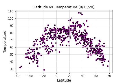
Temperature